Regular blog postings begin on DECEMBER 26, Monday.
Saturday, December 24, 2011
Friday, December 23, 2011
Japan Tsunami-Debris Cruise Attracts Travelers to Ocean Garbage Patch
From National Geographic: Japan Tsunami-Debris Cruise Attracts Travelers to Ocean Garbage Patch
The March 11 Japanese tsunami pulled millions of tons of debris from the country's coastline following the 9.0 magnitude earthquake off Sendai.
Since then, scientists have been tracking and monitoring the wreckage—bits of houses, whole cars, and household appliances—floating at sea, corralled by ocean currents in the North Pacific into an area researchers estimate could be the size of California. And now they're inviting the public along for the ride, for a price.
Few people have seen the floating tsunami debris field up close, and most have been scientists or crew members on shipping freighters. But in May 2012 Pangaea Explorations, the Algalita Marine Research Foundation and the 5 Gyres Institute—organizations that specialize in researching plastic accumulation in the oceans-will take scientists and paying members of the public to the floating field of ruins.
The trip aboard the Sea Dragon, a 72-foot (22-meter) sailing yacht, will loop the Pacific in two legs.
The first leg—a 23-day trip originating in the Marshall Islands, passing through the giant ocean vortex called the Western Pacific Gyre, and ending in Tokyo—has a small chance of encountering the tsunami debris field. (See pictures of debris from a Pacific garbage patch.)
But the second leg, originating in Tokyo, will follow the path of the debris with the specific intent of sampling it. That leg is to end 32 days later in Hawaii, where some of the material may come ashore as early the beginning of next year, according to predictions by the International Pacific Research Center.
Neither cruise is exactly a budget vacation, with the first leg priced at U.S. $13,500 per person (eight spots still available) and the tsunami-debris expedition at $15,500 per person (five spots available).
According to Jeanne Gallagher, office manager at Algalita, most of that hefty outlay goes toward food, fuel, research expenses, and insurance—paying passengers are often inexperienced sailors.
Any profit—which would be unexpected, according to Gallagher—would be used for further research.
"Pieces of People's Lives"
"The opportunity (to study plastic accumulation) has been laid in our laps through a natural disaster," Gallagher said.
"But we're also going to be sailing through pieces of people's lives, and we'll go through that with velvet slippers as much as we can."
Although this is a research mission to study the tsunami debris field, and not a recovery one, Gallagher said that if the team encounters any small objects that appear to be traceable to a person or a family in Japan, they will make every effort to return the items.
The project brings paying tourists to the debris field at a time when there's still concern in Japan about missing victims of the disaster. But Nori Akashi, a representative of the Japanese National Tourism Organization, said she does not believe the project will garner resentment, because the cruise is primarily a scientific venture.
Only 13 people, including 4 trained crew, will make each leg of the trans-Pacific crossing, so all participants will be integral and active in ship life, including keeping watch for navigational hazards in the debris field, sailing the boat, cooking, cleaning, and collecting scientific data.
Participants are also expected to help document any interesting sightings. All crew members, paying or otherwise, will sleep on bunks in a single large room.
Learning Plastic's Behavior
The samples they collect during several transects of the field will be used to determine and refine existing models of how fast the material is moving, how quickly it is decomposing, and the nature of the material's colonization by marine animals. Past trips to study marine debris with these organizations have attracted everyone from independent scientists to film crews and artists.
Findings gleaned from the tsunami debris are particularly significant because, unlike concentrated marine pollution elsewhere, the tsunami material's "launch" date and place of origin are known. With this information, researchers can better understand how land-based materials like plastics behave in the ocean.
One of the participants, Valerie Lecoeur, 41 of Winston-Salem, North Carolina, said she hopes to see where plastic accumulates in the ocean firsthand.
"For me it's interesting to see that there is debris from the ocean coming from events like tsunami—things that you can't control—and things that you can control as well."
Lecoeur plans to finance her trip through corporate sponsorship and online fundraising.
As a mom worried about BPA and toxic chemicals in plastic, Lecoeur started Zoë b Organic, which manufactures toys, dishes, and other children's items out of corn-based biodegradable plastics.
"I want to see for myself the scope of plastic pollution in our oceans and share what I will discover with my customers and retailers. I am planning on also reaching out to schools in North Carolina so they can follow the voyage and educate youngsters about what plastic does to our environment."
Crew members will be able to send updates and emails via satellite during the voyage.
Tsunami Objects May Still Be Intact at Sea
In September a Russian ship sighted an empty fishing boat from the Fukushima Prefecture—one of the areas hardest hit by the earthquake and tsunami. A TV set and refrigerator were also found in what was likely the outer edge of the debris field, 300 miles (480 kilometers) northwest of Hawaii's Midway Atoll. Algalita's Gallagher said that, while the tsunami-debris cruise's route is mostly defined, the return trip may include a stop on Midway to determine if any of the debris has washed ashore there.
Algalita Executive Director Marieta Francis said she expects the crew will encounter more large objects in the tsunami debris field than they might find in other areas of aggregated debris, like the Great Pacific Garbage Patch, because these materials will not have been worn down. In the Great Pacific Garbage Patch, tiny plastic pieces, worn down over years of exposure to the elements, dominate samples.
Marine debris is a serious hazard to aquatic life that can ingest it or become entangled in it.
Lecoeur, the North Carolina entrepreneur, said, "I wonder if on this trip, I will have the same feeling looking out at the ocean that I have on the beach. Looking across it, you see that the beach looks clean, but when you walk on it and look closely, you see all of these tiny bits of plastic."
Still, little is known about what the expedition might find.
"No one knows what to expect in the debris field," said Curtis Ebbesmeyer, an oceanographer who has studied ocean currents for more than 20 years and who is not involved with this trip. "Human remains in sneakers are possible. Expect the unexpected."
Tuesday, December 20, 2011
Papua New Guinea: The Capitol


>Port Moresbor Pot Mosbi in Tok Pisin, is the capital and largest city of Papua New Guinea (PNG). It is located on the shores of the Gulf of Papua, on the southeastern coast of the island of New Guinea, which made it a prime objective for conquest by the Imperial Japanese forces during 1942–43 in World War II, as a staging point and air base to cut off Australia from Southeast Asia and the Americas. In 2000 it had a population of 254,158. As of 2009 it has a population of 307,643, giving it an annual growth rate of 2.1% over a nine year period.
The place where the city was founded has been inhabited by the Motu-Koitabu people for centuries. The first European to see it was Captain John Moresby in 1873. It was named in honour of his father Admiral Sir Fairfax Moresby.
According to a survey of world cities by the Intelligence Unit of The Economist, Port Moresby is one of the world's least livable cities (ranked 137 of 140 cities rated).
Although Port Moresby is surrounded by Central Province, of which it is also the capital, it is not part of that province, but forms the National Capital District.
Papua New Guinea(PNG), officially the Independent State of Papua New Guinea, is a country in Oceania, occupying the eastern half of the island of New Guinea and numerous offshore islands (the western portion of the island is a part of the Indonesian provinces of Papua and West Papua). It is located in the southwestern Pacific Ocean, in a region defined since the early 19th century as Melanesia. The capital is Port Moresby.
Papua New Guinea is one of the most culturally diverse countries on Earth, with over 850 indigenous languages and at least as many traditional societies, out of a population of just under seven million. It is also one of the most rural, as only 18% of its people live in urban centres. The country is one of the world's least explored, culturally and geographically, and many undiscovered species of plants and animals are thought to exist in the interior of Papua New Guinea.
The majority of the population live in traditional societies and practise subsistence-based agriculture. These societies and clans have some explicit acknowledgement within the nation's constitutional framework. The PNG Constitution (Preamble 5(4)) expresses the wish for "traditional villages and communities to remain as viable units of Papua New Guinean society", and for active steps to be taken in their preservation.
After being ruled by three external powers since 1884, Papua New Guinea gained its independence from Australia in 1975. It remains a Commonwealth realm of Her Majesty Elizabeth II, Queen of Papua New Guinea. Many people live in extreme poverty, with about one third of the population living on less than US$1.25 per day.
Geography
At 462,840 km2 (178,704 sq mi), Papua New Guinea is the world's fifty-fourth largest country. Including all its islands, it lies between latitudes 0° and 12°S, and longitudes 140° and 160°E.
The country's geography is diverse and, in places, extremely rugged. A spine of mountains, the New Guinea Highlands, runs the length of the island of New Guinea, forming a populous highlands region mostly covered with tropical rainforest. Dense rainforests can be found in the lowland and coastal areas as well as very large wetland areas surrounding the Sepik and Fly rivers. This terrain has made it difficult for the country to develop transportation infrastructure. In some areas, airplanes are the only mode of transport. The highest peak is Mount Wilhelm at 4,509 metres (14,793 ft). Papua New Guinea is surrounded by coral reefs which are under close watch to preserve them.
The country is situated on the Pacific Ring of Fire, at the point of collision of several tectonic plates. There are a number of active volcanoes, and eruptions are frequent. Earthquakes are relatively common, sometimes accompanied by tsunamis.
The mainland of the country is the eastern half of New Guinea island, where the largest towns are also located, including the capital Port Moresby and Lae; other major islands within Papua New Guinea include New Ireland, New Britain, Manus and Bougainville.
Papua New Guinea is one of the few regions close to the equator that experience snowfall, which occurs in the most elevated parts of the mainland.
Land tenure
The PNG legislature has enacted various laws in which a type of tenure called "customary land title" is recognised, meaning that the traditional lands of the indigenous peoples have some legal basis to inalienable tenure. This customary land notionally covers most of the usable land in the country (some 97% of total land area); alienated land is either held privately under State Lease or is government land. Freehold Title (also known as fee simple) can only be held by Papua New Guinea citizens.
Only some 3% of the land of Papua New Guinea is in private hands; it[clarification needed] is privately held under 99 year state lease, or it is held by the state. There is virtually no freehold title; the few existing freeholds are automatically converted to state lease when they are transferred between vendor and purchaser. Unalienated land is owned under customary title by traditional landowners. The precise nature of the seisin varies from one culture to another. Many writers portray land as in the communal ownership of traditional clans; however, closer studies usually show that the smallest portions of land whose ownership cannot be further divided are held by the individual heads of extended families and their descendants, or their descendants alone if they have recently died.[citation needed]
This is a matter of vital importance because a problem of economic development is identifying the membership of customary landowning groups and the owners. Disputes between mining and forestry companies and landowner groups often devolve on the issue of whether the companies entered into contractual relations for the use of land with the true owners. Customary property – usually land – cannot be devised by will; it can only be inherited according to the custom of the deceased's people.
Religion
The courts and government practice uphold the constitutional right to freedom of speech, thought, and belief, and no legislation to curb those rights has been adopted. The 2000 census found that 96% of citizens identified themselves as members of a Christian church; however, many citizens combine their Christian faith with some pre-Christian traditional indigenous religious practices. The census percentages were as follows:
* Catholic Church (27.0%)
* Evangelical Lutheran Church of Papua New Guinea (19.5%)
* United Church (11.5%)
* Seventh-day Adventist Church (10.0%)
* Pentecostal (8.6%)
* Evangelical Alliance (5.2%)
* Anglican Church of Papua New Guinea (3.2%)
* Baptist (0.5%)
* Church of Christ (0.4%)
* Bahá'í Faith (0.3%)
* Jehovah's Witnesses (0.3%)
* Salvation Army (0.2%)
* Other Christian (8.0%)
There are also approximately 4,000 Muslims in the country. Non-traditional Christian churches and non-Christian religious groups are active throughout the country. The Papua New Guinea Council of Churches has stated that both Muslim and Confucian missionaries are active, and foreign missionary activity in general is high.
Traditional religions, such as that of the Korowai, were often animist. Some also tended to have elements of ancestor worship, though generalisation is suspect given the extreme heterogeneity of Melanesian societies. Prevalent among traditional tribes is the belief in masalai, or evil spirits, which are blamed for "poisoning" people, causing calamity and death, and the practice of puripuri (sorcery)
Geography, squatting blamed for Philippine floods
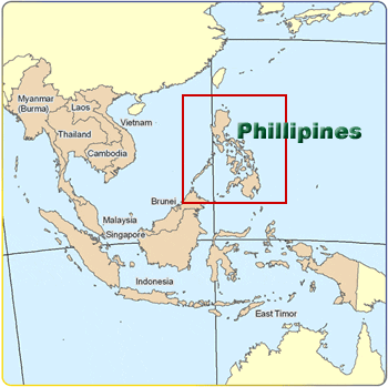
From Inquirer News: Geography, squatting blamed for Philippine floods
MANILA, Philippines—A freak storm, poor warning systems, flimsy buildings and human folly are all being blamed as Philippine officials struggle to explain one of the deadliest flash floods to have hit the country.
Entire villages were washed away when tropical storm Sendong (international name: Washi) whipped Mindanao island overnight Friday to Saturday, killing more than 650 people with hundreds still listed as missing Monday in a trail of flattened homes, broken bridges and upended vehicles.
Sandwiched between the sea and a wall of mountains, the ports of Cagayan de Oro and nearby Iligan, both built on the mouths of major rivers, are natural flood magnets, said Mines and Geosciences Bureau official Sevillo David.
“We are a country composed of hills and mountains as well as basins, and we are also frequently visited by rains and typhoons. Combining this you can expect flooding and landslides,” he told AFP.
The hardest-hit neighborhoods were shanty villages made of light materials built haphazardly atop loose deposits of river sediment, he said.
“When the water rises or there’s a flashflood these can be easily swept away.”
David, in charge of a five-year-old government program to map hazardous areas, said the bureau had recommended relocating residents out of the sandy island bars hit by the floods.
But the recommendations, which also included banning buildings within a kilometer (half mile) of the mouths of the Iligan and Cagayan rivers as well as dikes, were not followed.
“In a way, it takes political will to implement some of the recommendations. If you move people you need to find a relocation site for them,” David added.
President Benigno Aquino has ordered a review of the government’s defenses against natural disasters.
Mindanao, the southern third of the archipelago, is rarely hit by typhoons that regularly pound the northern island of Luzon every year, and residents were caught unprepared.
Cagayan de Oro’s mayor Vicente Emano insisted on Sunday that city officials had only learned about the looming storm from the media.
“Mindanao is usually not a typhoon-prone area that is why most residents were caught unprepared,” Gwendolyn Pang, secretary-general of the Philippine Red Cross, said in a statement.
“Climate is changing. We must also change the way we address climate issues,” she added.
Benito Ramos, head of the government’s national disaster council, suggested local officials and residents had ignored warnings of the approaching storm.
“They were forewarned these were risky areas. They were aware that they were in a flood-prone area and most of them are informal settlers,” Ramos said.
“They did not move because they had not experienced typhoons like this.”
A month’s worth of rainfall, about 180.9 millimetres (7.1 inches), fell over the region in the 24 hours before the deluge, according to preliminary weather service estimates.
Most victims were caught sleeping.
Anthony Lucero, a senior forecaster, said most of the heavy rain fell on mountains inland, generating the raging torrents that flowed down the rivers.
“Those rainfall levels rarely happen,” he told AFP, adding that Mindanao as a whole had been receiving heavier than usual rainfall this year due to La Nina, a cyclical warming and cooling of Pacific Ocean surface waters.
Saturday, December 17, 2011
What careers for a geographer today?
From Your Tricities News source: County planning director: We need full-time GIS person
BLOUNTVILLE, Tenn. -- Sullivan County needs to “bite the bullet” and hire a full-time GIS, geographical information system, person, the county’s planning director said Wednesday.
The county is in the middle of the redistricting process, which requires large amounts of technical and mapping data. A GIS professional uses satellite and geographical maps along with computer software. The person can adjust boundary lines, prints maps of certain areas of the county or locate an address after a 911 call.
“GIS is a powerful tool that can help all departments in the county,” Sullivan County Planning Director Ambre Torbett said.
The county uses a part-time private contractor, Russ Davis at Landmark GIS. Sullivan County has $30,000 in the annual GIS budget and uses Davis six or eight hours a week. The extensive mapping work for the redistricting has used a large portion of the budget and Torbett said the county might not be able to use Davis for a couple months after the work is completed.
At Wednesday’s Sullivan County Commissioners Redistricting Committee meeting, some commissioners were concerned about not being provided information in a prompt fashion.
A full-time GIS person could improve the process, Torbett said.
“There is so much work that we could be doing to make everyone’s life easier,” she said, adding, “This committee isn’t the only one that could benefit from a highly skilled GIS person.”
Commissioner Mark Bowery said he supports the idea and wants to work with Torbett to see if it is possible to hire someone. Torbett said she would draft a resolution for review.
She said she has been trying to get a full-time GIS person at the county for a couple of years.
“I ask the mayor [Steve Godsey] and he says these are hard economic times, and we don’t have the money,” Torbett said.
Davis said the GIS system is an important tool for counties and other governments and added that it is “limitless” how much a full-time GIS person could help the county.
Friday, December 16, 2011
Amundsen Becomes First to Reach South Pole, December 14, 1911
From Scientific American: Amundsen Becomes First to Reach South Pole, December 14, 1911
One hundred years ago today (December 14) the South Pole was reached by a party of Norwegian explorers under the command of Roald Amundsen. The existence of the pole had been known, but the inhospitable landscape presented a barrier until Amundsen’s party made the dangerous trek across ice and snow to stand at the geographical South Pole on this day a century ago.
One of Amundsen’s competitors, Robert Falcon Scott and his party, achieved a different kind of fame: they arrived on January 17, 1912 to find they were second in the race to fame, and they perished on their way back north.
News of Amundsen’s achievement was telegraphed to the world on March 7, 1912, on his return to Hobart, Australia.
From Scientific American, Vol. CV1, No. 11, March 16, 1911
The Discovery of the South Pole
It is much too early to give any critical account of Capt. Roald Amundsen's achievement. Many weeks must elapse before we are in complete possession of all his data. Yet even the laconic account, which he has cabled to the press, throws a flood of light on the mystery of Antarctic geography. Amundsen seems to have collected enough evidence to substantiate the theory that the great chain of mountains which extends almost uninterruptedly from Alaska to Patagonia finds its continuation in a ridge connecting Victoria Land and King Edward VII Land, and which, in honor of his queen, he has named "Queen Maude's Range."
The ice barrier, which had proved for a century and a half a formidable obstacle to Antarctic exploration, is found to terminate in a bay, lying between the southeast mountain range running from South Victoria Land and a range which is probably a continuation of King Edward the VII Land and which extends in a southwesterly direction. Contrary to his original plan, Amundsen despatched one of his officers, Lieut. Prestud, to survey the Bay of Whales and the great ice barrier and to explore King Edward VII Land, of which practically nothing is known. No doubt the spur of competition played its part in unfolding the secrets of the last unexplored frigid region of the earth.
Amundsen and his party at the geographic South Pole, December 14, 1911.
CREDIT: PHOTO COURTESY OF NORWEGIAN-U.S. SCIENTIFIC TRAVERSE OF EAST ANTARCTICA
No less than four other expeditions were in the Antarctic regions at the time while Amundsen was forcing his way south. Besides Amundsen's, there was the Japanese expedition under Lieut. Shirase, which had to retreat to Australia last spring in order to replenish its supply of dogs, and which Amundsen says landed on January 16th at the Bay of Whales, two weeks before he sailed for home; Dr. Mawson's Australian expedition, for which $215,000 had been raised up to November 1st last, and which was to land three parties between Cape Adare and Gaussberg; the German expedition under Lieut. Filchner in the "Deutschland," elaborately equipped with wireless, magnetic, and meteorological apparatus, full of the hope of establishing a base southwest of Coats Land in as high a latitude as possible; and lastly, Capt. Scott's English expedition in the "Terra Nova," which left New Zealand in November, 1910, badly damaged by stormy weather; so badly, indeed, that the necessary repairs and the cost of making good the stores that had been lost seriously depleted the resources of the party.
Amundsen seems to have been helped by exceptionally favorable weather conditions. To be sure, there were storms, but not those frightful hurricanes which thwarted Shackleton. It was cold, so cold that the dogs suffered visibly; yet the average temperature was no lower than that in many an inhabited part of Canada. Amundsen himself states that part of his journey was much like a pleasure trip--"excellent ground, fine sledging, and an even temperature." The glaciers and crevasses make detours necessary, yet, despite them, progress was remarkably rapid. The party climbed up 2,000 to 5,000 feet in a day. Throughout much of his journey Amundsen covered entirely new ground. Therefore he will bring back absolutely new information of Antarctic geography. He made up his mind that he would reach the plateau on which the Pole is situated by another route than that of Beardmore Glacier. Luck, instinct, experience, call it what you will, the new route proved easier than that which either Shackleton or Scott took on their expeditions. To that comparatively easy route, coupled with exceptionally favorable weather, may be attributed Amundsen's success.
Monday, December 12, 2011
Kashmir underwater? A Colorado geologist thinks it’s possible

Kashmir from Wikipedia
Kashmir is the northwestern region of the Indian subcontinent. Until the mid-19th century, the term Kashmir geographically denoted only the valley between the Great Himalayas and the Pir Panjal mountain range. Today Kashmir denotes a larger area that includes the Indian-administered state of Jammu and Kashmir (the Kashmir valley, Jammu and Ladakh), the Pakistani-administered Gilgit-Baltistan and the Azad Kashmir provinces, and the Chinese-administered regions of Aksai Chin and Trans-Karakoram Tract.
In the first half of the first millennium, the Kashmir region became an important center of Hinduism and later of Buddhism; later still, in the ninth century, Kashmir Shaivism arose.
In 1349, Shah Mir became the first Muslim ruler of Kashmir and inaugurated the Salatin-i-Kashmir or Swati dynasty.[2] For the next five centuries, Muslim monarchs ruled Kashmir, including the Mughals, who ruled from 1526 until 1751, then the Afghan Durrani Empire that ruled from 1747 until 1820.
That year, the Sikhs under Ranjit Singh, annexed Kashmir. In 1846, upon the purchase of the region from the British under the Treaty of Amritsar, the Dogras—under Gulab Singh—became the new rulers. Dogra Rule, under the paramountcy (or tutelage) of the British Crown, lasted until 1947, when the former princely state became a disputed territory, now administered by three countries: India, Pakistan, and the People's Republic of China.
From Washington Post.com: Kashmir underwater? A Colorado geologist thinks it’s possible
By Rama Lakshmi
NEW DELHI — A recent U.S. prediction of a possibly devastating earthquake in the disputed Himalayan province of Kashmir has caused alarm here in India.
A study by Roger Bilham, professor of geology at the University of Colorado, Boulder, concludes that a magnitude-9 earthquake could strike in Kashmir, triggering massive landslides and plunging the picturesque valley under water.
Newspapers in Kashmir carried front-page stories on Bilham’s predictions Saturday, stirring public fears.
“People have been calling me all day since they read the news in the papers. They are frightened. I wish the newspapers had not run it on the front page. Why create a scare?” said Muhammad Ismail Bhat, former head of geology and geophysics at the University of Kashmir, who has worked with Bilham. He said he had known about the new findings for a while.
Until recently, most forecasts about the tectonically active Himalayan region have been based on historical data and information generated by GPS stations in neighboring Indian states and in Pakistan. But since 2007, as many as nine stations have been set up in the state of Jammu and Kashmir itself, providing new data to local and international analysts.
At the annual meeting of the American Geophysical Union in San Francisco this week, Bilham said that new GPS data showed gradual movement of rocks in the Zanskar Mountains, north of the Kashmir valley, that he said could result in a Japan-level quake and kill about 300,000 people. The subsequent landslides would dam the Jhelum River, and when released, the backed-up water could cause flooding, he said.
In 2005, a 7.9-magnitude quake with its epicenter in Muzaffarabad, in Pakistan-administered Kashmir, caused widespread damage and killed more than 40,000 people. Seismologists recorded several tremors in the region in August this year.
Subscribe to:
Posts (Atom)