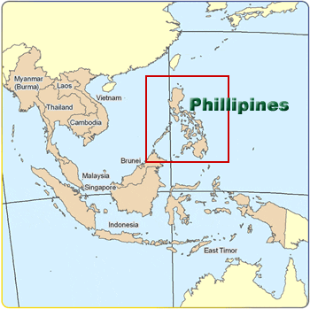
From Inquirer News: Geography, squatting blamed for Philippine floods
MANILA, Philippines—A freak storm, poor warning systems, flimsy buildings and human folly are all being blamed as Philippine officials struggle to explain one of the deadliest flash floods to have hit the country.
Entire villages were washed away when tropical storm Sendong (international name: Washi) whipped Mindanao island overnight Friday to Saturday, killing more than 650 people with hundreds still listed as missing Monday in a trail of flattened homes, broken bridges and upended vehicles.
Sandwiched between the sea and a wall of mountains, the ports of Cagayan de Oro and nearby Iligan, both built on the mouths of major rivers, are natural flood magnets, said Mines and Geosciences Bureau official Sevillo David.
“We are a country composed of hills and mountains as well as basins, and we are also frequently visited by rains and typhoons. Combining this you can expect flooding and landslides,” he told AFP.
The hardest-hit neighborhoods were shanty villages made of light materials built haphazardly atop loose deposits of river sediment, he said.
“When the water rises or there’s a flashflood these can be easily swept away.”
David, in charge of a five-year-old government program to map hazardous areas, said the bureau had recommended relocating residents out of the sandy island bars hit by the floods.
But the recommendations, which also included banning buildings within a kilometer (half mile) of the mouths of the Iligan and Cagayan rivers as well as dikes, were not followed.
“In a way, it takes political will to implement some of the recommendations. If you move people you need to find a relocation site for them,” David added.
President Benigno Aquino has ordered a review of the government’s defenses against natural disasters.
Mindanao, the southern third of the archipelago, is rarely hit by typhoons that regularly pound the northern island of Luzon every year, and residents were caught unprepared.
Cagayan de Oro’s mayor Vicente Emano insisted on Sunday that city officials had only learned about the looming storm from the media.
“Mindanao is usually not a typhoon-prone area that is why most residents were caught unprepared,” Gwendolyn Pang, secretary-general of the Philippine Red Cross, said in a statement.
“Climate is changing. We must also change the way we address climate issues,” she added.
Benito Ramos, head of the government’s national disaster council, suggested local officials and residents had ignored warnings of the approaching storm.
“They were forewarned these were risky areas. They were aware that they were in a flood-prone area and most of them are informal settlers,” Ramos said.
“They did not move because they had not experienced typhoons like this.”
A month’s worth of rainfall, about 180.9 millimetres (7.1 inches), fell over the region in the 24 hours before the deluge, according to preliminary weather service estimates.
Most victims were caught sleeping.
Anthony Lucero, a senior forecaster, said most of the heavy rain fell on mountains inland, generating the raging torrents that flowed down the rivers.
“Those rainfall levels rarely happen,” he told AFP, adding that Mindanao as a whole had been receiving heavier than usual rainfall this year due to La Nina, a cyclical warming and cooling of Pacific Ocean surface waters.
No comments:
Post a Comment