Wednesday, October 31, 2012

Book Review: Remains of the invasion of Wild West

From the Star Phoenix:  Remains of the invasion of Wild West

"Let's just say that it all began when Keith and I took a trip." That's the folksy and disarming style with which prolific Saskatoon writer Candace Savage takes us into her latest book, A Geography of Blood.
But what begins as a wide-eyed discovery of a part of the province she had barely noticed before becomes a gradual unearthing of all the mysteries she feels that part of southwest Saskatchewan has kept hidden for years.
She and her partner, Keith, stumbled onto Eastend driving up from Wyoming back in September 2000. Their happy accident led to a brief visit, which parlayed through a stay at the Wallace Stegner House, into them buying their own home and becoming part-time citizens of Eastend.
Savage then goes on to tell how she and Keith drove off in just about every direction at once, trying to explore this country new to them, and how they endured breakdowns and getting lost. "If you've never squeezed into the cab of a tow truck with three dogs, you really haven't lived," she cheerfully relates, all part of that easygoing feel with which she cushions her reader. But there's more going on here.
Before she even got to East-end she made fun of a Wild West show in Cody, Wyo., blasting the iconic Buffalo Bill for his reputed killing of 4,860 buffalo in "just 18 months."
And before she's got out to see the new big draw in Eastend, the T. Rex Discovery Centre, celebrating Scotty, another in a long line of local dinosaurs, Savage takes issue with iconic, short-stay Eastend author Wallace Stegner and his famous book Wolf Willow. There's something about the book that bothers Savage, but she can't put her finger on it.
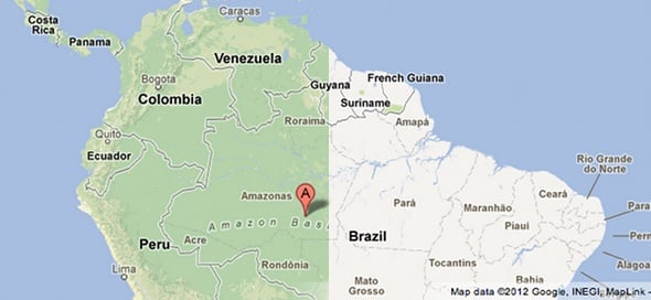
With a title like A Geography of Blood, you just know it isn't going to be dinosaur blood, even after the jolly time she has with the kind people at the museum. She finds teepee rings on a walk and, with Stegner's avowed discomfort over an almost ghostly native presence swirling in her head, begins to ask herself, as Stegner did, how the mainstream white population to which she belongs made the jump from untamed frontier to peaceful farm country.
Attentive fiction and history readers will know about Guy Van-derhaeghe's Englishman's Boy, with its graphic depiction of the Cypress Hills Massacre of 1873, and Walter Hildebrandt and Brian Hubner's 2007 history of the Cypress Hills - Savage mentions them in her bibliography - to say nothing of the burgeoning First Nations literature that is telling its own stories of the West. But this is Savage's own awakening to how, somehow, she - a historian in her own way - missed the wholesale disappearance of First Nations people from the prairie to make way for her people, the settlers. But, of course, they haven't disappeared and she goes looking for them.
A Geography of Blood is one woman's encounter with the silence that blows across all the tee-pee rings, arrowheads and buffalo skulls that still lie in southwest Saskatchewan. She writes it as a mystery, because it's a mystery to her, even with those aforementioned books in her library. She finds Fort Walsh and Farwell's Trading Post. She learns about the treaties to settle whole nations of people in the Cypress Hills and how the Canadian government reneged on those agreements. She finds the successful native farming initiative, abandoned, and the hunger camps that followed: First Nations people were starved into going to reservations the government wanted them to take so they'd be out of the way of the new arrivals. And to see the modern wreckage of those official policies, she joins a talking circle at the federal correctional centre outside Maple Creek.
To people who know the stories or books that tell of the forced starvation and eviction of the Plains First Nations people from their land, as well as the outright destruction of the entire bison ecosystem, Savage's story is a familiar one. But not familiar enough to the population at large. Keith tells her, "There are a lot of things that nobody talks about ... in the imposition of colonial power," and this sad tale is one of them.
The glorious achievement of Huck Finn in his journey down the Mississippi with the Black slave Jim is his gradual realization that Jim is a human being, just like him. Candace Savage makes a similar journey in her awakening to what treaties and mass destruction mean to whole nations of human beings. No matter what you think you know, and maybe especially if you think you know a lot, you can learn a great deal from A Geography of Blood.

A GEOGRAPHY OF BLOOD Unearthing Memory from a Prairie Landscape By Candace Savage, Greystone, $26.95

Tuesday, October 30, 2012

West Virginia DEP contracts with MU Geography Department to employ student interns to convert paper mine maps to GIS format

From Huntington News:  West Virginia DEP contracts with MU Geography Department to employ student interns to convert paper mine maps to GIS format 

HUNTINGTON, W.Va.– The West Virginia Department of Environmental Protection (WVDEP) has sub-contracted with Marshall University’s Geography Department to employ student interns to convert paper mine maps to Geographic Information Systems (GIS) database format.
The contract for the GeoMine project is actually a renewal of a previous contract that lasted from December 2011 to September 2012. The current contract, which provides an additional $129,000 in funding from the WVDEP, runs through December 2013.

“This is a feather in our cap,” said Dr. David Pittenger, dean of the College of Liberal Arts. “Our Department of Geography offers an outstanding education that allows students to learn both the political-economic-historical perspective of geography as well as the powerful tools used to create complex maps using GIS technology.”

Dr. James M. Leonard, a geography professor and director of the Geography Department GIS Lab, said the contract has so far employed 12 different undergraduate and graduate students. He said the GeoMine project is a joint venture among several federal agencies, notably the U.S. Office of Surface Mining, Reclamation, and Enforcement and several state-level environmental protection agencies, including the WVDEP.

“The project goal is to create a Geographic Information Systems database for monitoring and regulating coal mining in Appalachia,” Leonard said. “I expect additional students to be hired as the needs of WVDEP may require. One hundred percent of the funding has gone to students.”


Monday, October 29, 2012

Google Adds Geographic Terrain Imagery To Maps

From Hot Hardware:  Google Adds Geographic Terrain Imagery To Maps


Google continues to improve upon its Google Maps; earlier this week it announced that Googlers were mapping the Grand Canyon with backpack-mounted cameras, and now the company has added layers to its maps that show the terrain, color gradation indicating vegetation, and additional labels that show natural land formations.

This is all an effort to show locations with more intelligence and context. For example, if you can see where a mountain range is located, the location and layout of surrounding big cities and rural countryside make more sense.

Google Maps Amazon Basin
L: The new terrain and vegetation overlay; R: the old look of Google Maps

Further, it’s somewhat marvelous to be able to see important geological areas labelled. The example Google gave in a blog post is of the Amazon Basin. When you can see the thick vegetation, wide area, and helpful label on that area of South America, you can appreciate the magnitude of that place.

The concept of maps is a powerful one, and never before have people had such convenient and powerful access to maps with this breadth and depth. A curious mind could get lost for hours poking around different parts of the globe with Google Maps.


Sunday, October 28, 2012

Q: Who is Washington's Whidbey Island named after?

From the Seattle Times:  Geography quiz: Who is Whidbey Island named after?

Q: Who is Washington's Whidbey Island named after?

A: Joseph Whidbey, an English naval officer who circumnavigated the island in 1792 on Captain George Vancouver's ship.

Saturday, October 27, 2012

Explorer of the Week: Elena Garcea

From National Geographic:  Explorer of the Week: Elena Garcea

Elena Garcea, a member and leader of multiple National Geographic archaeological projects in Africa, has always been interested in studying ancient people’s lifestyles. When she’s not in the field, she teaches paleoethnology and interprets the data from the field.
What project are you working on now?
My current field research takes place in a small island in the Nile River, Sai Island, and on the west bank of the Nile (Amara West) in Upper Nubia, northern Sudan. I’m investigating the major economic and cultural shifts that took place between 10,000 and 4,500 years ago, when the latest hunter-gatherers started to produce their food with domesticated animals and plants, adopting animal herding first, and then plant cultivation. These shifts involved changes in the settlement systems, the production of different pottery vessels and stone tools, and the establishment of new social relations. I usually spend one or two months a year in the field.
What inspires you to dedicate your life to archaeology?
I like my job because it allows me to work with both my hands and my brain. I enjoy working in the field in Africa, and I am attracted to understanding the beginning of things. My major interests focus on the spread of early Homo sapiens—our human species—as they moved out of Africa between 80,000 and 50,000 years ago, first reached southwestern Asia, and then Europe. I’m also fascinated by the dynamics that occurred when the latest hunter-gatherers started to produce their food and domesticated animals and plants, adopting animal herding in Africa some time after 10,000 years ago. An assemblage of worked stones, or potsherds, has many stories to tell us. It can reveal how the people who made those stone tools and those pots adjusted to the environment where they lived, how they survived and developed, and how they related with other groups who lived in the surroundings. Prehistory is the science that deals with common people, their behavior, and their lifestyles. It teaches us to think about a geography and a history different from those designed in the last 2,000 to 3,000 years by wars and armistices, conquerors and vanquished, rulers and subordinates.
Garcea examines two joining potsherds, or broken pieces of ceramic material. Photograph by Roberto Ceccacci

What’s the biggest surprise you’ve discovered in your work or in the field?
When I was working in the central Sahara desert, I discovered the archaeological remains of the earliest humans of our species, Homo sapiens, who left East Africa and gradually moved towards North Africa, Europe, and then the Middle East. Nobody knew at the time—it was the early 1990s—that the early representatives of our species lived in the Sahara, which was not a desert then, around or slightly before 100,000 years ago. Even the experts in this field had denied it. Understanding the out-of-Africa movements of early Homo sapiens subsequently became another major interest of mine.
If you were to meet your eight-year-old self, what would you say?
“You always wanted to be an archaeologist and you made it!” Young people should find a passion in what they would like to do. Passion is the key to overcome the difficulties and the obstacles that every job can bring.
If you could trade places with one explorer at National Geographic, who would it be and why?
I would switch jobs with Zinhle “Zinny” Thabethe because she can change the world. While I work to uncover the past, she works for the future to cure and educate HIV/AIDS patients by bringing hope with the music of her choir. She is a person I deeply admire. She can successfully contribute to afflicting problems with her artistic talent. My work is similar, in a way leading an archaeological team is like conducting an orchestra. You need the cooperation of every single voice.
What do you think National Geographic explorers will be exploring in a hundred years?
Many of the diseases that we are creating with our careless attitudes, as well as everything existing on Earth and in space. However, I hope National Geographic will continue to support archaeological research and understand the value of knowing our human past. A hundred years is not a whole lot of time for an archaeologist.
Picture of Garcea on the Nile river
Garcea on the Nile river, Photograp by Roberto Ceccacci
What one item do you always have with you?
I always have a handkerchief in my pocket. I hate using paper tissues as they are polluting, tearable, and hard to dispose of in the field. Handkerchiefs can be useful for many purposes (wiping, holding something that is too hot or too cold, unscrewing jars, etc.).
What is your favorite National Geographic magazine article?
The Black Pharaohs” by Robert Draper. The archaeology of Sudan has been long neglected and here it is very clearly presented. Some of it, at least.
If you were to bring back one species of animal that has gone extinct, what would it be?
I would like to meet Homo habilis, the earliest member of the same genus as ours, Homo sapiens. Homo habilis evolved around 2.3 million years ago and became extinct around 1.4 million years ago in Africa. He is the first species for which there is evidence of use of stone tools.


Thursday, October 25, 2012

Shared geography: Dive into the confluence

From RiverFallsJournal:  Shared geography: Dive into the confluence

A National Park Service conference in 2009 sparked the idea of local communities working together to share common concerns, foster partnerships and encourage tourism.
The Confluence Project started not long after with local and regional people working toward the goal of creating a common vision of education, conservation and recreation at the confluence of the Mississippi and St. Croix rivers.
Members of the project include people from two national parks, the Mississippi National River and Recreation Area and the St. Croix National Scenic Riverway; the Carpenter Nature Center in Hastings, Minn.; the Friends of Freedom Park in Prescott; the Minnesota DNR; Pierce County, Wisc.; Dakota and Washington counties in Minnesota; the city of River Falls; Prescott; and the Minnesota cities of Afton and Hastings.
Mayors from each of the cities gave a presentation Friday, Oct. 12, at the River Falls Public Library describing their town’s unique characteristics.
River Falls Mayor Dan Toland told about the Kinnickinnic River’s unique attributes, as well as the many opportunities for recreation in and around it.
Toland highlighted the city’s trails, history tours, many festivals and more. Resident and longtime member of the Community Arts Base Sue Beckham also presented information.
Website builder Mandy Matzek also spoke to the crowd as she showed the site on a big screen: “Its main job is to inform,” she said, adding that the designers of it worked hard to procure photography that highlights the stunning visual beauty of the area.
She explained that the website includes a powerful map feature with layers that already show many of the region’s natural assets. It will continue to grow and expand to include more things.
The speakers said the symposium was the official “soft” launch of the website that intends to bring visitors to and from all four areas of the confluence.
Members of GRC define its geography this way: “This project encompasses the physical territory around the confluence of the Mississippi and St. Croix rivers located in the greater Afton, Hastings, Prescott and River Falls areas.”
The site aims to promote not only the region’s natural beauty, but also its fishing, boating, canoeing, hiking, commercial shipping, trains, swimming, motorcycling, biking, hiking, history and more.
The Confluence Concierge portion of the website gives visitors a chance to zero in on specific activity packages that might include music, wine, patio dining, dessert, a bed-n-breakfast stay, or a creative combination of several things.
Margaret Smith, executive director for the Friends of Freedom Park Center, said she often receives requests from people looking for that kind of guidance.
For example, maybe they’d ride bikes or motorcycles into town and ask where they could hear live music along the route.
Others may want to do outdoor recreation then fine dining. People can choose and create any number of combinations that take them to the four main communities of the GRC.
As people raised their hands to mention or ask about specific areas, activities or entities, the presenters made clear that the website is and will always be a work in progress.
The idea is to add to it, enrich it and give people something that helps them come and enjoy all the region has to offer.
“We also recognize there are a lot of things missing on here that we need to add,” said Gene Groebner of the Minnesota DNR.
Presenter Matzek agreed, “Partnerships are going to be key.”
Symposium packages included a list of all the attendees to encourage immediate networking and communication. Participants spent the first part of the day inside the library hearing presentations and seeing the site. They were on a bus tour for the second part of the day that included seeing River Falls parks along the Kinnickinnic River and trails, the new Point Douglas Trail site, the Carpenter Nature Center, the new Hwy 61 bridge and its trail, Hastings trails and a prairie restoration project, and the LeDuc Historic Estate and Prescott’s Orange Dragon Art Gallery.
The presenters encouraged everyone to check out the site, refer other people to it and provide feedback.
Much more information is available about the Great Rivers Confluence Project and its activities at the newly launched website:
www.greatriversconfluence.org.


Wednesday, October 24, 2012

Geography presentation goes Greek

From the Daily Eastern News:  Geography presentation goes Greek


An associate professor of geography will shed light on the legacy of ancient Greek geographers Thursday.
Michael Cornebise, an associate professor of geography and the chairman of the Eastern geology/geography department, will present “Ancient Greek Geography and Geographers” in room 2120 of the Physical Science Building at 2:30 p.m.


The lecture is part of “A Futuristic Look Through Ancient Lenses: A Symposium on Ancient Greece.”
Cornebise said he was so impressed after watching several presentations during the Symposium on Ancient Egypt last year that he wanted to participate this year.

He said his lecture will explore how the ancient Greeks’ ideas influence current scientific practices.

Many concepts used in modern applications of geography are attributed to ancient Greek geographers such as Hecataeus of Miletus, Eratosthenes, Theophilus, Strabo and Ptolemy, he said.

“As geographers, we trace our roots to the ancient Greeks,” he said.

Cornebise said he would use many visual aids to engage the audience in history.

Some images will be of ancient maps showing the significance of cartography, which is the art and science of map making.

“We owe a lot to how they constructed their maps,” he said.

He said it is important for those studying geography to examine historic records in order to trace the origins of their ideas.

“One of the threads that runs through the whole spectrum is how we relate practices to modern life,” he said. “The connection (with Greece) is a lot clearer than other ancient societies.”

Beth Heldebrandt, the editorial writer for library services, said the symposium has expanded to offer more programs than the previous one on Ancient Egypt because of positive responses from students.

She also said more than 100 people were present for the opening ceremony in Booth Library, and the first two lectures of the series have been successful.


Friday, October 19, 2012

International Geography Olympiad Success

From Scoop (NZ):  International Geography Olympiad Success

In difficult and busy times for the education sector it is always good to have good news, says Professor John Overton. The NZ Geographical Society has received a report on New Zealand successes in the International Geography Olympiad. All four secondary school geographers won medals reports Overton. Their success in 2012 sits alongside those of the five other subjects of the Science Olympiads New Zealand (SONZ); Physics, Chemistry, Biology, Informatics and Mathematics.
The five day Geography Olympiad was held in Cologne, with three testing examination sessions. Scott Cameron and Brent Coleman from Hamilton Boys High School both won silver medals, with Sidney Wong (Hutt Valley High School) and Connor Clemett (Riccarton High School) getting bronze medals. 34 countries competed, with Singapore the overall winner in 2012.

In a separate team competition the New Zealand poster presentation shared the Dr Prill prize for cartography. The team leader, Anna Wilson from Wellington, reported that the team had written the poster material and trained well for the presentation. She said the team always thought they had a good chance with the theme of well-suited to New Zealand. The theme was “Water as a key national resource”.
Professor Overton acknowledged the work of the teachers who had led New Zealand international teams in Geography since 2006. “They do a great job, and allow our students to be excellent ambassadors for the country, taking our culture and our landscapes to an international audience”. He also noted the value of a government grant that meant students had to raise only about 50% of their fares and participation costs.

New Zealand successes in Cologne. From left, Sydney Wong (Hutt Valley), Scott Cameron and Brent Coleman (Hamilton Boys) and Connor Clements (Riccarton) show off their medals.

Thursday, October 18, 2012

Is geography behind sea-ice paradox?

From The Japan Times: Is geography behind sea-ice paradox?

SINGAPORE — When sea ice covering the Arctic Ocean fell to a record-low level last month, much of the analysis in Asia and the Pacific focused on the opening of new and shorter commercial shipping routes to Europe, and increased access to Arctic offshore oil and gas resources.
These could be very positive developments for the region, especially for the energy-short trading economies of Northeast Asia led by Japan, China and South Korea.
But the dramatic decline in both the extent of Arctic sea ice and its thickness since the start of reliable satellite measurements in 1979 may also signal an alarming acceleration in global warming and climate change caused mainly by burning fossil fuels and clearing forests.
Sea ice is an extensive layer of frozen ocean water that cools the polar zones — the Arctic in the Northern Hemisphere and Antarctica in the Southern Hemisphere. It also helps to moderate the global climate.
Sea ice has a bright surface. As a result, about 80 percent of the sunlight that strikes it is reflected back into space. However, as sea ice melts in the summer, it exposes the dark ocean surface that then absorbs approximately 90 percent of the sunlight. The ocean warms and Arctic temperatures rise further.
Yet there is a seeming paradox between what is happening to sea ice in the Arctic, where it is shrinking fast, and Antarctica, where it has been expanding steadily in recent years.
Climate-change skeptics claim that the growth in Antarctica offsets the retreat of sea ice in the Arctic, demonstrating that nature has a self-righting mechanism. Skeptics question dire warnings from many climate scientists of a warmer world by the end of the century that will set the stage for a long period of catastrophic extreme weather and rising sea levels as the great land-based ice sheets start to melt, first Greenland in the Arctic, and then on a much larger scale in Antarctica.
Research suggests that the two polar zones are reacting differently to measured warming of the atmosphere and seas in both places because of geography. Antarctica is a vast continent encircled by water, whereas the Arctic is an ocean surrounded by exposed land, which reacts more quickly to warming atmospheric temperatures than Antarctica's seas or its thick ice sheets.
Wind and ocean currents around Antarctica isolate it from global weather patterns, keeping it very cold. By contrast, the Arctic Ocean is closely linked with the land climate systems around it, making it more sensitive to change.
Arctic sea-ice loss is cited as one of the most striking and earliest examples of climate change and what it will mean for the future of life on Earth. That it is happening in the Northern Hemisphere, where most of the world's people live, accentuates the potential severity.
The latest polar measurements unveiled by the U.S. National Snow and Ice Data Center (NSIDC) earlier this month showed that Arctic summer sea ice extent reached its lowest point this year on Sept. 16, when it covered 3.41 million sq. km, nearly 3.3 million sq. km below the 1979 to 2000 average.
Ten days later, Antarctica's winter sea ice reached its maximum extent of 19.44 million sq. km, slightly higher than the previous record in 2006. Arctic summer sea ice decline has been far faster than the growth of Antarctic winter sea ice. But the relevant comparison is really summer minimums and winter maximums in each hemisphere.
From 1979-1983 in the Arctic, the summer minimum of sea ice covered an average of just over 51 percent of the ocean. It fell to just 24 percent of the ocean surface this year. In Antarctica, the comparable figures were 13.8 percent and 14.6 percent of the ocean, meaning that summer sea ice shrinkage in the northern hemisphere is greatly outstripping growth in the southern hemisphere.
The same sharp contrast is evident in the winter sea ice maximum of both polar zones between 1979 and 2012. The decline in Arctic winter ice extent is eight times as fast as the increase in Antarctic winter ice.
That still leaves the question why Antarctic sea ice is increasing when local and global temperatures are warming?
Scientists will not know the answers until more research is done. But they think it is partly the result of wind and ocean movements. NSIDC director Mark Serreze also attributes a role to the hole in the ozone layer above Antarctica. He explains that because of this, the stratosphere above Antarctica is very cold.
"Ozone in the stratosphere absorbs UV (ultraviolet) light, and less absorption (by) ozone makes the stratosphere really cold," Serreze says. This cold air descends to the surface, keeping the sea ice extensive.
In the rapidly warming Arctic, the Greenland ice sheet has been melting, leading to substantial net ice loss in recent years. The worry is that if global warming continues on the track predicted by many climate scientists, Antarctica's sea ice and its vast land-based ice sheet will eventually follow.
After all, research has shown that about 52 million years ago, when the concentration of carbon dioxide — the main greenhouse gas from human activity today — was more than twice its current level, Antarctica had palm trees and other tropical vegetation. Summer temperatures on the coast ranged between 20 and 27 degrees Celsius.

Monday, October 15, 2012

Pupils to learn about 200 key British figures from Anglo-Saxons to Winston Churchill as 'politically correct' national curriculum in history is scrapped

From Daily Mail:  Pupils to learn about 200 key British figures from Anglo-Saxons to Winston Churchill as 'politically correct' national curriculum in history is scrapped

History lessons will be rewritten to include 200 key figures, such as Winston Churchill, and events which shaped Britain under a new national curriculum drawn up by education secretary Michael Gove.
The current syllabus, previously attacked for being too politically correct, will be scrapped with the intention of giving children a deeper understanding of history.
Under new plans school children will learn a narrative about British history and key international developments, including the fall of the Roman Empire, the union that created Britain and the decline of its power.
Winston Churchill and Anglo-Saxon monarchs Alfred and Athelstan will also be put on the list of leaders that children will study.
Gove’s blueprint rejects learning by rote, but emphasises that acquiring a detailed knowledge of history will enable children to understand the reasons behind human failures and achievements, The Sunday Times reported.
Secondary school children aged between 11 and 14 will move on to 50 wider topics about the modern world, including Soviet-U.S. relations and how they shaped the world, as well as the influence of immigration on British society.
The national curriculum review was launched in January 2011 but only drafts in primary school maths, English and science have been released.
The new primary and secondary curriculum documents currently being considered cover art and design, citizenship, English, geography, history and physical education.
Headmistress of North London Collegiate school Bernice McCabe, co-director of the Prince’s Teaching Institute and member of the committee advising on the curriculum review, told The Sunday Times: ‘It is not a backward-looking curriculum but very forward-looking.
‘Teachers from the Prince’s Institute have said over the years that there has been a move too much towards skills without sufficient emphasis on the knowledge that you need to use them.
‘In history, for example, we do not see how you can have a good foundation of knowledge without understanding the chronology of events.’
The current version of citizenship, which includes topics such as identities and diversity and how to negotiate, plan and take action has been cut back from 29 pages to one for 11 to 14-year-olds.
The new syllabus will focus on the British monarchy and parliamentary democracy as well as theories on liberty and rights.
In geography, primary children will study physical features, the nature of rocks, rivers and mountains, the names of countries and the characteristics of countries as well as how glaciers shape landscapes.
Later on in secondary school the topics will become more specific, including aspects of human geography, like the industrial expansion of Asia.
Alan Kinder, chief executive of the Geographical Association, advising on the review, told The Sunday Times: ‘ There is concern that pupils…don’t seem to be acquiring the world knowledge that we would expect them to have and most people in the geography subject community feel there needs to be something of a rebalancing.’
It follows criticisms of the current curriculum for failing to ensure children learn about human and physical processed which shape geography.
The PE curriculum is now expected to emphasise the need for physical exertion, amid concerns the current programme requires too little fitness.
The education department refused to comment on the drafts but said they will be made public 'in due course'.


England: Award puts school on map

From Hartlepool Mail:  Award puts school on map 

Clavering Primary School pupils (left to right) Mia, Luke, Ellie-Mae and Duane Clavering Primary School pupils (left to right) Mia, Luke, Ellie-Mae and Duane

A TOWN primary school has been chosen as one of a select few nationwide to receive a prestigious award.
Clavering Primary School, in Clavering Road, Hartlepool, has gained the Geographical Association’s Primary Geography Quality Mark, one of only 51 schools in the country to be handed the award.
The award recognises excellence in the geography curriculum in schools and also acts as a useful tool as it gives teachers access to action plans and learning materials.
Deputy headteacher Neil McAvoy said: “At Clavering we are committed to ensuring quality leadership at all levels and this award very positively reflects on the fantastic work carried out by our geography leader Tamsin Murray.
“She is our geography subject co-ordinator and also leads on a variety of other geography-related aspects of our wider curriculum such as our eco-school work, gardening projects and our outdoor learning zone.” Miss Murray said: “Geography is an essential part of our child-centred approach to learning and plays an important role in our vision to develop imagination, creativity, citizenship and an awareness of the world around us, leading to a thirst for knowledge and an interest in exploration.”
The award is the latest boost for the school, which has recently celebrated receiving Fairtrade school status and the full International School Award, as reported in the Hartlepool Mail last week.


Thursday, October 11, 2012

Knox, research pioneer in streams and soils, dies

From University of Wisconsin-Madison:  Knox, research pioneer in streams and soils, dies

Jim Knox, 70, Evjue-Bascom professor emeritus of Geography at the University of Wisconsin-Madison, died at his home in Madison on Saturday, Oct. 6. Although he had retired in 2011, he continued to work in Science Hall.
Photo: Jim Knox
Knox
A memorial service will take place on Friday, Oct. 12 at noon, with a visitation beginning at 10 a.m., at Cress Funeral Home, 3610 Speedway Road.
During his 43 years as a faculty member at UW-Madison, Knox’s research transformed the field of fluvial geomorphology (studying streams and the landforms they produce), opening new avenues that linked his field to broader contemporary environmental issues. To tens of thousands of students, he was a much-loved teacher, explaining not only how streams and soils work, but why we should care about them.
“I first met Jim when I was a new Ph.D. student on a field trip through southwestern Wisconsin on a cold, early spring weekend,” recalls Matt Kuchta, now an assistant professor of geology physics at UW-Stout, in a remembrance on his blog. “He had so much to share [that] he would talk to both vans via the walkie-talkie. He spent so much time talking about the rivers and fluvial history of the area [that] he ended up draining the batteries in the walkie-talkie more than once. . . His work on the impact of humans on river systems continues to shape the work that I do now.”
The hills and valleys of Wisconsin’s Driftless Area served as Knox’s “laboratory.” He carried out his best known work near the Grant County farm where he grew up, inspired by the winding streams and the glacial history of the Quaternary Period.
“At a gathering last year to commemorate Jim’s career, former graduate students often turned to descriptions of Jim enthusiastically surveying stream channels in the Driftless Area, in cold, wet weather or fading light,” says Joe Mason, professor of geography. “In recent decades, he told me, he often helped his brother with work on the family farm, once noting that he had gone from putting up hay one afternoon to sitting on a National Science Foundation advisory panel in Washington the next day.”
James C. Knox was born in Platteville on Nov. 29, 1941. His early experiences made him a firm believer in the Wisconsin Idea, and in the value of research and teaching at the University of Wisconsin to the people of the state. After earning degrees from UW-Platteville and the University of Iowa, he came home to Wisconsin to take a faculty position at UW-Madison in 1968.
“As his colleagues, we knew him as a model citizen of his department, university and profession. He was always willing to dedicate his time, good nature and common sense to work for the greater good.”
Joe Mason
Knox’s best-known research was on the sometimes-dramatic changes in the magnitude and frequency of floods and the behavior of streams in general. His widely cited 1993 paper in the journal Nature demonstrated that, over the past several thousand years, even modest changes in climate caused large changes in the frequency of large floods along Driftless Area streams. To detect the effects of land use change, he used metal contamination from 19th century lead and zinc mining as a tracer, showing that the rates of soil erosion and sedimentation on floodplains increased dramatically as forest or prairie was turned into farmland.
Knox also played an important role in encouraging the developers of climate models to compare their simulations of past climates with data from the field. His research, supported by numerous grants from the National Science Foundation, was recognized with awards including the Lifetime Achievement Award from the Association of American Geographers, received earlier this year.
Throughout his career, Knox taught large lecture courses in physical geography with enthusiasm and skill, often using illustrating them with examples from his research. Always happy to explain his work to the public in other venues, he was featured in a PBS program on floods in the Mississippi River basin.
Despite the time he spent on research and teaching, Knox rarely, if ever, turned down requests for service. He chaired his department and the Physical Sciences Divisional Executive Committee, among others. Nationally, he was a councilor of the Association of American Geographers and the American Quaternary Association, chair of Section E (Geology and Geography) of the American Association for the Advancement of Science, and chair of the Quaternary Geology and Geomorphology Division of the Geological Society of America. He was a member of numerous panels and advisory boards of the National Science Foundation and an associate editor of several leading journals in geography and earth science.
Knox conveyed the importance of service to academia to the many graduate students he supervised.
“As his colleagues, we knew him as a model citizen of his department, university and profession. He was always willing to dedicate his time, good nature and common sense to work for the greater good,” says Mason.
Knox is survived by his wife Kathy and daughters Sara and Lezlie, a


Friday, October 5, 2012

WV: Archaeology Day to be unearthed at Putnam Farmers Market

From Charleston Daily Mail : Archaeology Day to be unearthed at Putnam Farmers Market

Archeology Day at the Putnam Farmers Market in Hurricane City Park will be from 10 a.m. to 1:30 p.m. Saturday.
Those who bring personal artifacts may have items identified by professionals from Cultural Resources Analysts and Council for West Virginia Archeology.
West Virginia Archeology Society will sell publications and films. Those who have VHS players may get free copies of "Ghosts of Green Bottom" and "Red Salt and Reynolds."
For more information, contact Bob Maslowski at bobwinecel...@yahoo.com or 304-743-5257.

Thursday, October 4, 2012

Archeologists discover Saka burial in South Kazakhstan

From CaspioNet: Archeologists discover Saka burial in South Kazakhstan

Archaeologists have discovered a unique find in what is now Shymkent.

It is a Saka burial with two gold discs displaying marine life dating back presumably to the fourth and second centuries BC. Now, according to scientists, it is 100 percent clear that ancient Sakas lived in what is now Shymkent.

Anatoly SHAYAKHMETOV, EMPLOYEE, A. MARGULAN INSTITUTE OF ARCHEOLOGY:
-It is perhaps a symbiosis of Saka and Sarmatian cultures. It never happened here before as the Sarmatians lived in the West and Saks lived in the Zhetysu region in southern Kazakhstan. This is something new to our culture and perhaps it will push the limits of the Silk Road’s origin.

Scientists say that two people were buried here. However, one of the skeletons has not been preserved as the bones of presumably a man were strewn by robbers. Another skeleton belongs to a woman, most likely a slave. According to scientists, it is no accident that a board and a jug were buried next to the remains.

Bauyrzhan Baitanayev, Director, A. Margulan Institute of Archeology:
-When we opened the second burial, we found a lot of pottery fragments and sigs that they were richly buried and there was a gold foil that robbers left behind. This find will now be on display at the museum and we will open a new page in the relations of our ancestors to Europe.

Scientists revealed only 4 out of 8 burial mounds for the time being. Archaeologists hope that the most sensational discoveries are still ahead. Works will continue in the area for another two years.

Tuesday, October 2, 2012

Travel Column: Keep your GPS, I’ll take a map

From the Toronto Star:  Travel Column: Keep your GPS, I’ll take a map

My favourite book is the atlas.
My nickname at one time was Mr. Geography.
My basement has two clear plastic boxes filled to the brim with maps of places I’ve been. And a few I haven’t.
I’m not a Luddite when it comes to technology. I don’t mind GPS systems. I’ve used one on occasion; mostly recently a year and-a-half ago when I was in Ireland and wanted to take a lot of small country roads. Other than suggesting I make an immediate left turn into a concrete barrier the middle of a divided highway at 100 km/hour it worked pretty well.
You might read it incorrectly, but a good, old-fashioned map will never override your common sense and suggest that massive cliff out the passenger window is actually a shortcut to Highway 123. A map doesn’t require a charged battery or a Wi-Fi connection. A map can be tucked in your knapsack or your car’s glove compartment without worrying about it getting stolen. And you won’t see signs on the subway suggesting you keep your map hidden away from other riders in case you might tempt them into an act of robbery.
You can’t pick up your iPhone and close your eyes and run your finger over the screen and then open your eyes to see where you’re going to live when you get older, either.
There are a couple drawbacks to a map. For one, it’s expensive to get a good one of downtown St. Pete’s and also Dunedin and Tampa and Orlando. Also, you’ll look like a tourist if you pull out your map while walking in Manhattan in a way you wouldn’t by consulting your Blackberry. And, yes, some tourist maps are pure evil. The scale is ridiculous and they only show some of the streets in Paris and leave you wandering for hours in search of that charming bistro you were told about on Rue Mouffetard that you promised your wife you’d take her to make up for the fact you forgot July 24 was your anniversary and had to explain why you were driving with your buddies to Buffalo for a chicken wing festival.
But most maps are wonderful creations with perfect information that’s easy to digest and follow and I love them. Not only do they help you figure out where to go, they often have cool photos or illustrations; castles and towering, green palm trees and world-renowned architectural wonders.
I love the history I have with my maps, and the stories they tell me. When I rummage through my North America map box (I have one for Canada and the U.S. and the other box is for further flung destinations, and it’s probably the only act of organization in my house that I’m responsible for), I can see the squiggles of a line in faded yellow and see the words “Sky Harbor” and immediately know that’s my map of Phoenix, which I had when we took a family trip there and my young daughter fell on the sidewalk and got a rather serious scratch that ran down the length of her nose.
I’ve got another one of Sacramento from 1975, which reminds me of rafting trips we used to take down the Sacramento River and how my girlfriend’s roommate once told a mutual friend of ours that she had a surprise for him and walked into the room stark naked, or so he said.
Some of the maps are bent and folded and mutilated and torn enough to resemble a Florida election ballot, but I love them.
I have in my collection a huge map of Nice, France, which always reminds me of how I booked a room on the Promenade des Anglais in 1979 and was given a tiny bed in what literally was a janitors? closet and then went to a fabulous courtyard café nearby and ordered a salad that I thought had a few tomatoes but was instead, much to my horror, a salad made up entirely of tomatoes, a fruit I consider (in its uncooked state) to be as vile as anything on earth.
An atlas, on the other hand, is all the glories of a map times, like, 1,000. The entire world is the atlas; maps of Kazakhstani mountains and Ecuadorian lakes and Stockholm islands. And maps of the ocean floors and of both sides of the moon, which has features named Grissom and Chretien in case you didn’t know. I have an old Readers Digest atlas from about 1965 or so that shows the built-up form of Toronto and there are vast stretches of rural land all around what is now the bustling Scarborough Town Centre.
You can pick up a National Geographic Atlas and find the average day-time high in Moscow in January is minus-9 with an average 16 days of precipitation, while in Santiago Chile it’s plus-29 with an average number of precipitation days of zero.
How can you beat that?


Monday, October 1, 2012

Humboldt: Seemann, Hunt and Vroman-Little: Three women shared a love for running

Not specifically about geography, just a note about drunk drivers - as these women had to have been hit by a drunk driver. The bastard had to be drunk - how else could he not see three women jogging along the side of the road??

Don't drink and drive!

From the Willits News: Humboldt: Seemann, Hunt and Vroman-Little: Three women shared a love for running
http://www.willitsnews.com/ci_21660883/seemann-hunt-and-vroman-little-three-women-shared


Humboldt State University geography lecturer Suzanne Seemann, 40, is remembered by friends and colleagues as a well-respected teacher who was dedicated to her family and active in the running community.
Seemann was killed Thursday morning in a hit-and-run collision while jogging along Myrtle Avenue with two other women. Eureka residents Jessica Hunt and Terri Vroman-Little were severely injured.

The mother of a 7-year-old and a 4-year-old, Seemann had been running with the two women for years, said Six Rivers Running Club President Gary Timek. Timek said the three women had previously run the Boston Marathon together.

Seemann, who specialized in weather and climate change, had been with HSU Geography Department since 2011. She previously taught at College of the Redwoods, a statement from HSU President Rollin Richmond said. Seemann held degrees from the University of Wisconsin, Massachusetts Institute of Technology and Princeton.

”Suzanne's colleagues in the Department of Geography have shared with me their keen sorrow at her loss,” Richmond said. “They describe her as an extraordinarily talented and popular instructor, one who will be sorely missed.”

Geography professor Stephen Cunha said the close-knit nature of the department, and HSU as a whole, made the loss even more difficult.

”She was just loved by her students,” Cunha said. “She was an absolutely brilliant woman.”


Cunha said Seemann could have made “gobs of money in the private sector,” but she instead chose to settle in Humboldt County, where her husband Hank Seemann is originally from, to teach and raise a family. Hank Seemann is the county's deputy director of environmental services.

”She chose to work as a lecturer, and devote the rest of her time to family,” Cunha said. “She loved the ability to dwell on her subject and share it with students for half a day, and then spend the other half with family. Students loved her for that.”


Jessica Hunt
Jessica Hunt, 41, survived but suffered major injuries in the hit and run. She underwent surgery at St. Joseph Hospital Thursday afternoon. A hospital spokeswoman said Hunt was in stable condition Friday.
An entry on the Six Rivers Running Club Facebook posted early Friday afternoon said that Hunt is “doing better today, but still is not totally coherent and has not been told the sad news (about the death of Seemann).” A post later in the evening said Hunt was out of the Intensive Care Unit.
”She is going to make it,” said Six Rivers Running Club member Cindy Timek. “We're happy. It was touch and go for a minute there.”

According to a Six Rivers Running Club statement on behalf of the families, Hunt and her husband have two boys. She is a teacher at Mistwood Montessori School and the director of the 34th Annual Humboldt Redwoods Marathon.

Hunt's dog, Maggie, was also killed in the accident. Maggie was described as a “beloved running dog/partner,” in a Six Rivers Running Club statement.


Terri Vroman-Little
Terri Vroman-Little, 50, also survived the hit-and-run, and is in stable condition.

The Six Rivers Running Club Facebook page said she “heard the sad news about (Suzanne Seemann) and is devastated at this time.” A St. Joseph Hospital spokeswoman confirmed that Vroman-Little was in stable condition Friday.

Vroman-Little teaches at Redwood Coast Montessori School. She and her husband have a daughter and a son, Cindy Timek said.

”She's a really good runner, and her daughter just ran her first 10k,” Cindy Timek said.